WAMP - Waltham Abbey Maps and Plans
About WAMP
ⓘ
?
©
✉
FIRST
PREV
NEXT
LAST
34 / 188
WAMP:
34
Item:
1
Date:
1879 (Surveyed 1870)
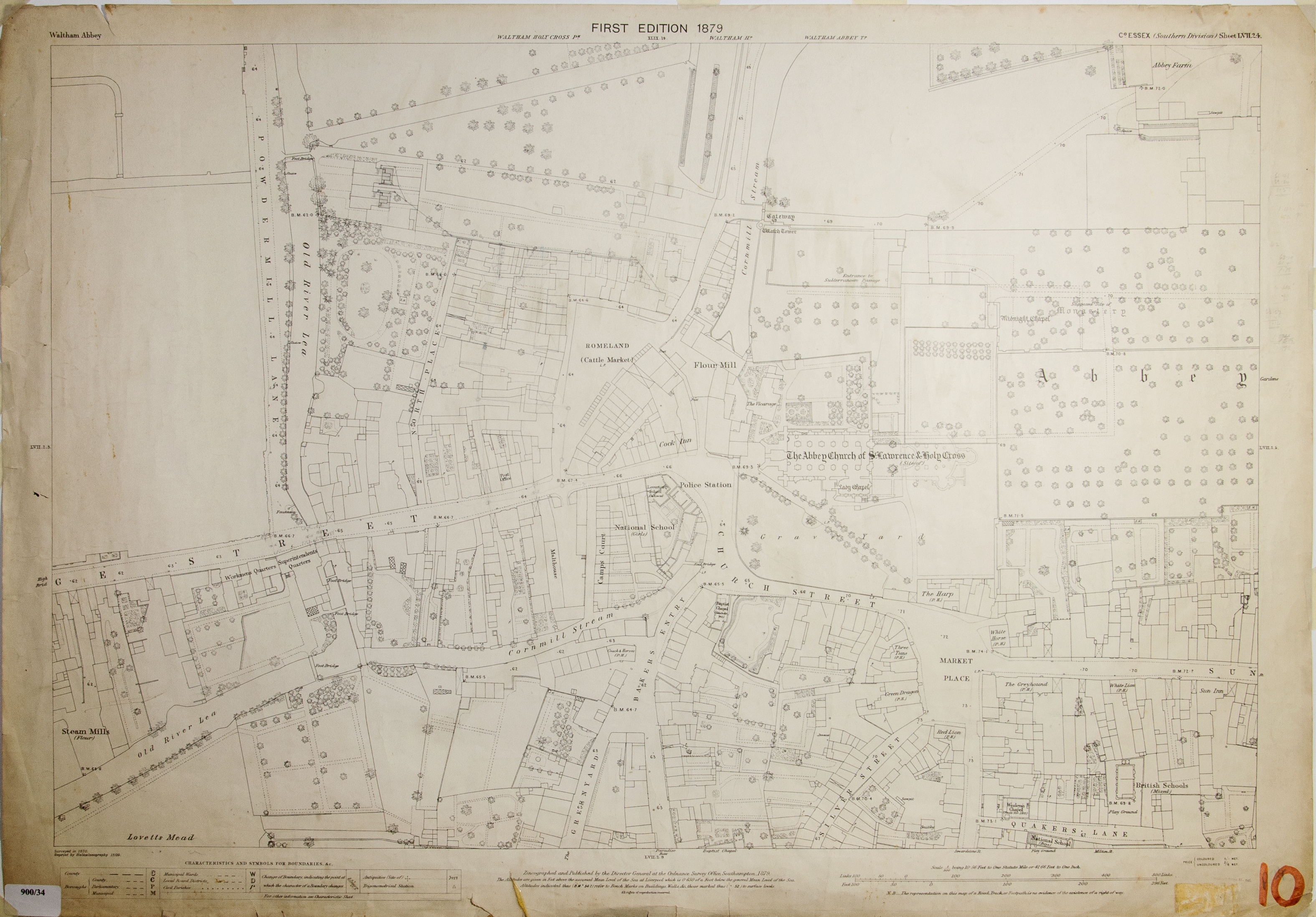
Subject:
Waltham Abbey 1st Edition 1879 (Reprint 15/09) Covers Powdermill Lane, Romeland and Market Place "Plan of High Bridge Street shewing Width of Road between River Lee Navigation Bridge and corner of fish shop opposite Bakers Arms"
Size:
38'' x 26''
Scale:
1:500
PRO Reference:
Map Number:
10
Location:
APC
Photographer:
SD
WASC:
0900
Filename:
wamp-0900-034.jpg
Share
Download JPG (4.9 MB):
wamp-0900-034.jpg
Click Image to Zoom, etc.
 Click Image to Zoom, etc.